
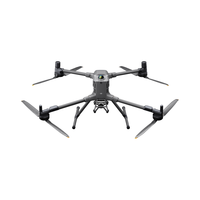
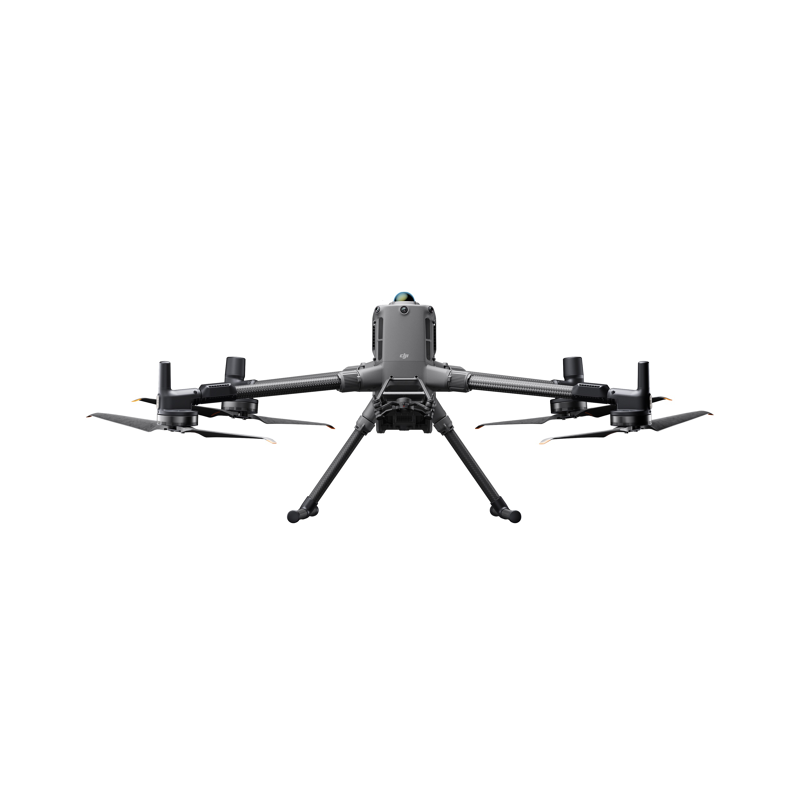
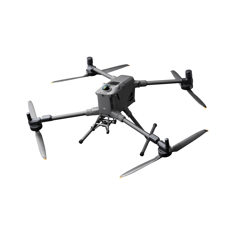
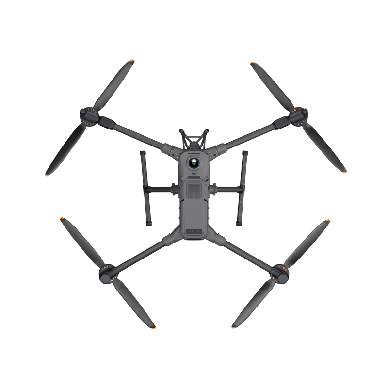
DJI Matrice M400 dronas
10 956,20 €
tax excl. 21%

Extended Flight Time
Matrice 400 has a forward flight time of up to 59 minutes [2], a hover time of up to 53 minutes [6], and an IP55 protection rating [7].
Upgraded Payload Capacity
Depending on the task, Matrice 400 can be equipped with the Zenmuse H30 Series, L2, P1, S1 Spotlight, Manifold 3[8], or third-party payloads.
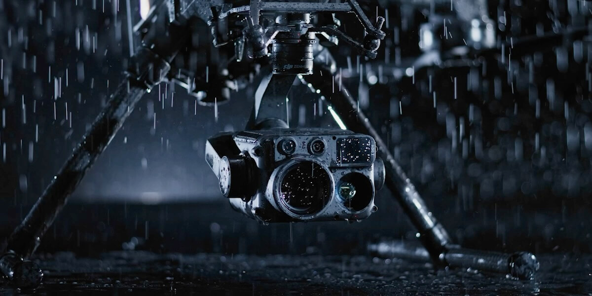
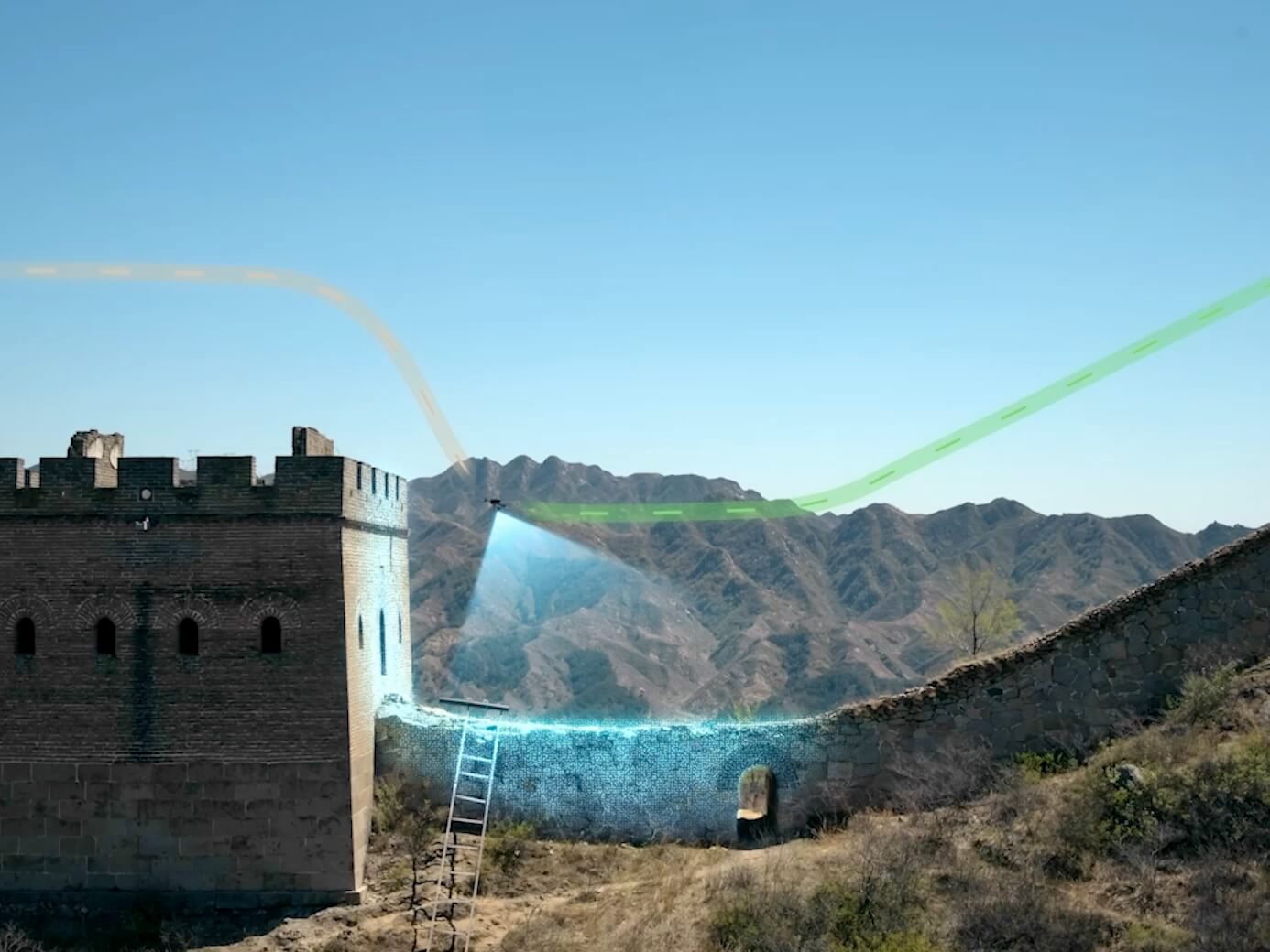
Power-Line-Level Obstacle Sensing
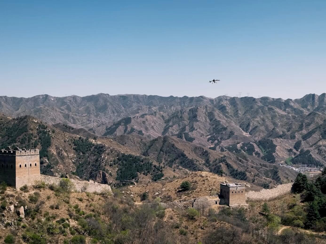
With LiDAR, mmWave radar and low-light fisheye vision sensors, Matrice 400 detects power lines across mountainous terrain — even in darkness [3].
Enhanced Intelligence & Efficiency
Matrice 400 boosts efficiency with Smart Detection, Smart AR Projection, Real-Time Terrain Following [9], and ship-based takeoff/landing [10].
Easier Automated Operations
Matrice 400 enables automated power line inspection flights with Zenmuse L2 [8], as well as Slope and Geometric Route planning with FlightHub 2.
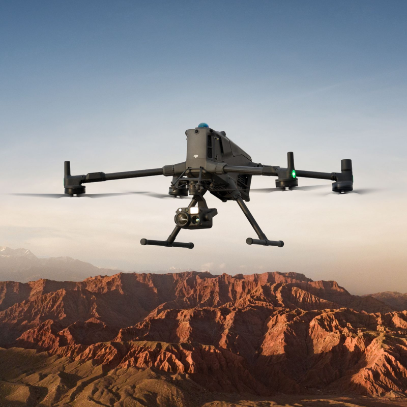
Long-Endurance Drone Platform With Power-Line-Level Obstacle Sensing

DJI Matrice 400
Engineered for Excellence, Designed for Versatility
Endurance
Payload
Safety
Intelligence
Automation
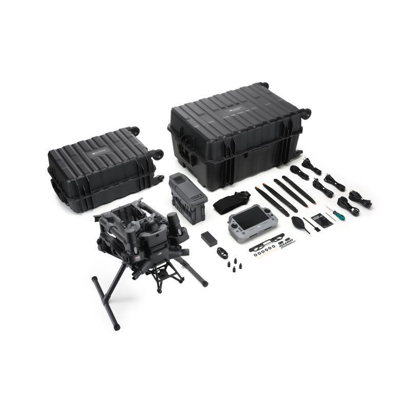
Accessories
DJI Care
DJI Matrice 400, the enterprise flagship drone platform, boasts an impressive 59-minute flight time [1], a payload capacity of up to 6 kg [2], and integrated rotating LiDAR and mmWave radar for power-line-level obstacle sensing [3]. It also supports the O4 Enterprise Enhanced Video Transmission and Airborne Relay Video Transmission [4], ensuring safer handling and easier operations. Combining Smart Detection with visible and thermal imaging, AR projection, ship-based takeoff/landing, and advanced automation, Matrice 400 excels in emergency response, power inspections, mapping, and AEC.
Extended Flight Time, High Speed Performance
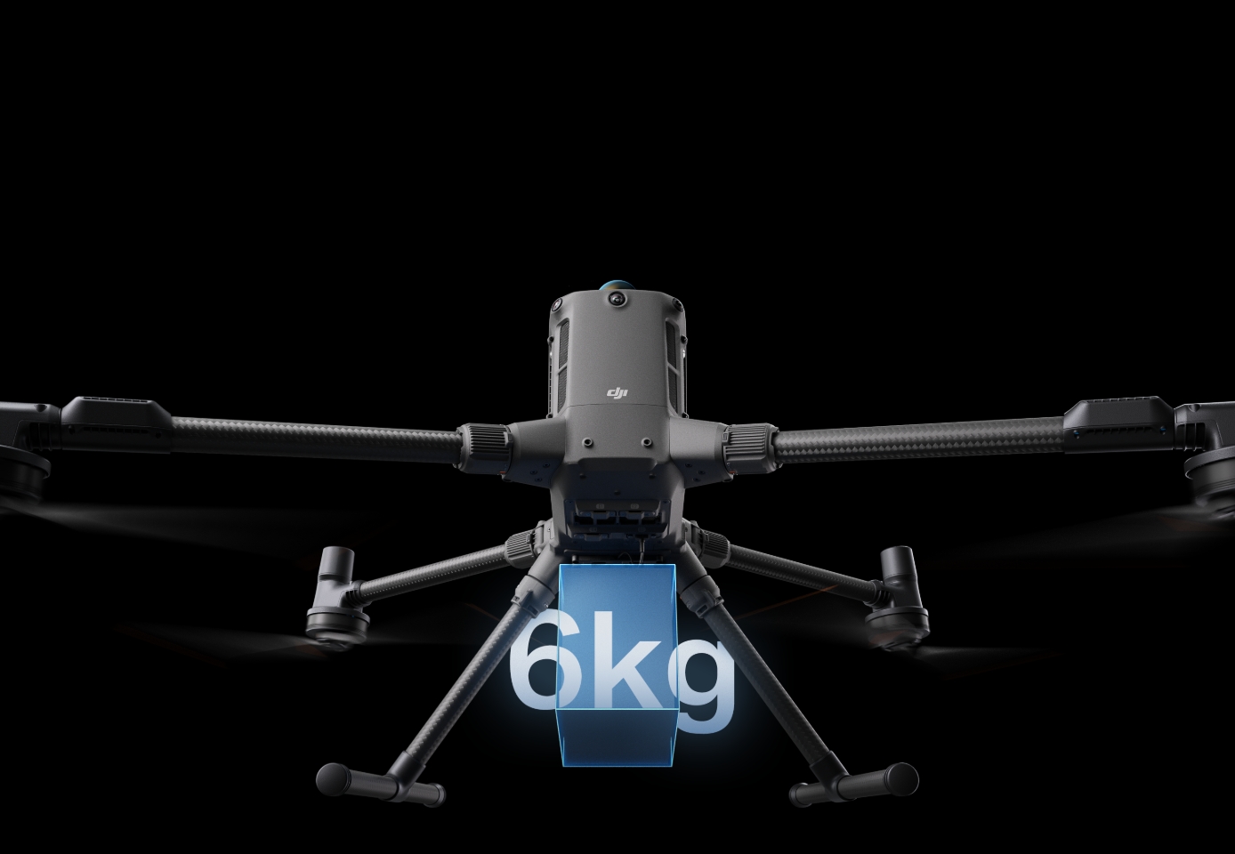
Up to 6kg [2] Payload Capacity
Safe and Reliable Flight
Enhanced Intelligence and Efficiency
Automated Operations
Comprehensive Accessory Upgrades
DJI Care Enterprise
Extended Flight Time, High Speed Performance
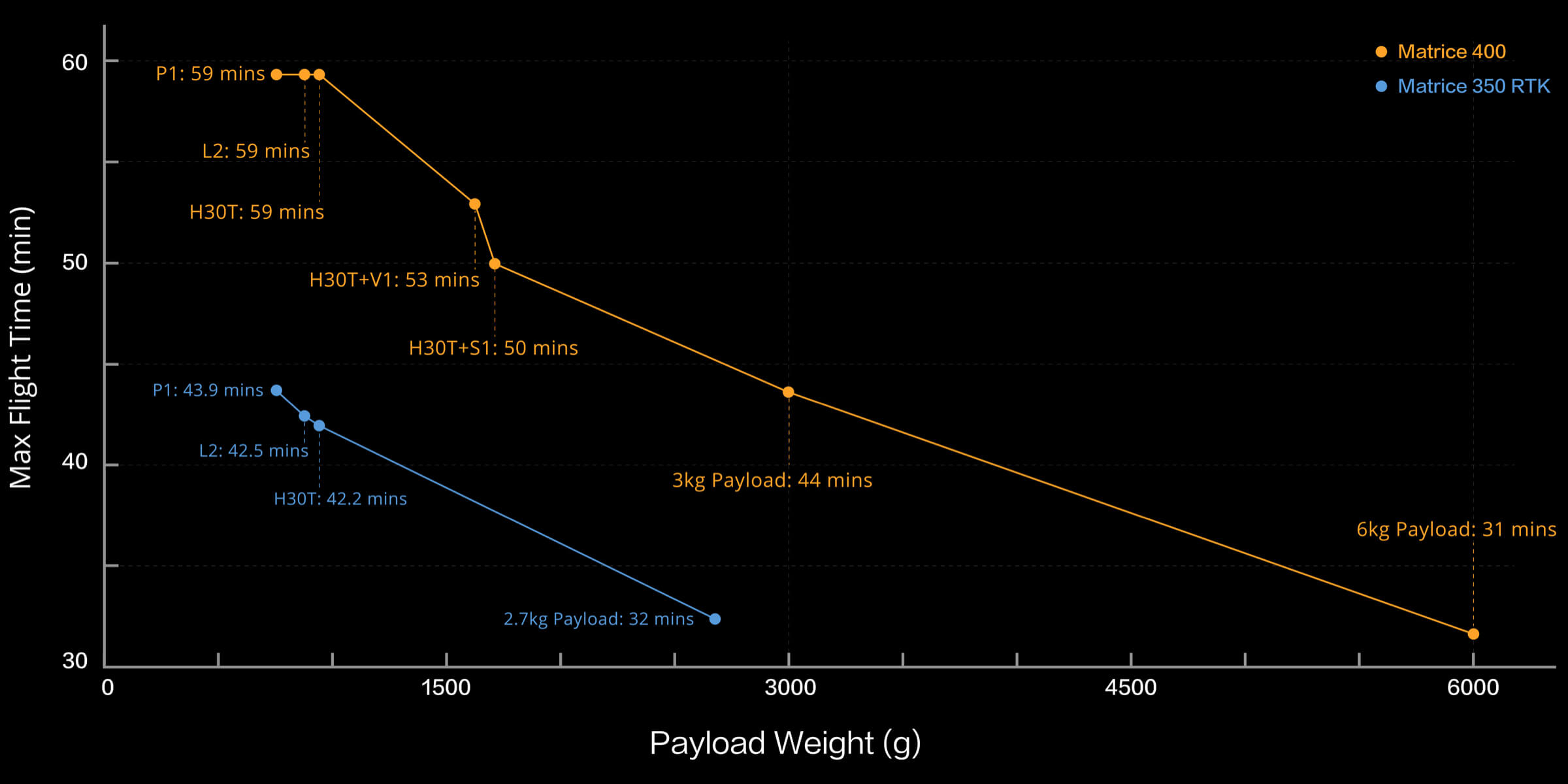
Matrice 400's flight capabilities are outstanding, offering up to 59 minutes of forward flight time even with a payload, and up to 53 minutes of hovering duration [6]. These capabilities make it a reliable tool for long-duration and continuous operations such as search and rescue, firefighting, and large-scale mapping. It can also avoid large obstacles [3] like buildings and mountains at flight speeds of up to 25 m/s.
Up to 59Mins
Forward Flight Time
Up to 25m/s
Flight Speed
Multi-Payload, Multi-Scene
Matrice 400’s strong payload capacity allows it to easily meet the demands of a wide range of applications. With a maximum payload capacity of 6 kg [2], Matrice 400 supports seamless switching between a single downward gimbal [8] and a dual downward gimbal [8]. It also features a third gimbal connector on the underside for additional flexibility. The aircraft is equipped with 4 external E-Port V2 ports [7], enabling simultaneous mounting of up to 7 payloads.
Depending on the task, Matrice 400 can be equipped with the Zenmuse H30 Series, L2, P1, S1 Spotlight, V1 Speaker, Manifold 3, or third-party payloads, thereby expanding its capabilities and unlocking the full potential of the DJI ecosystem.
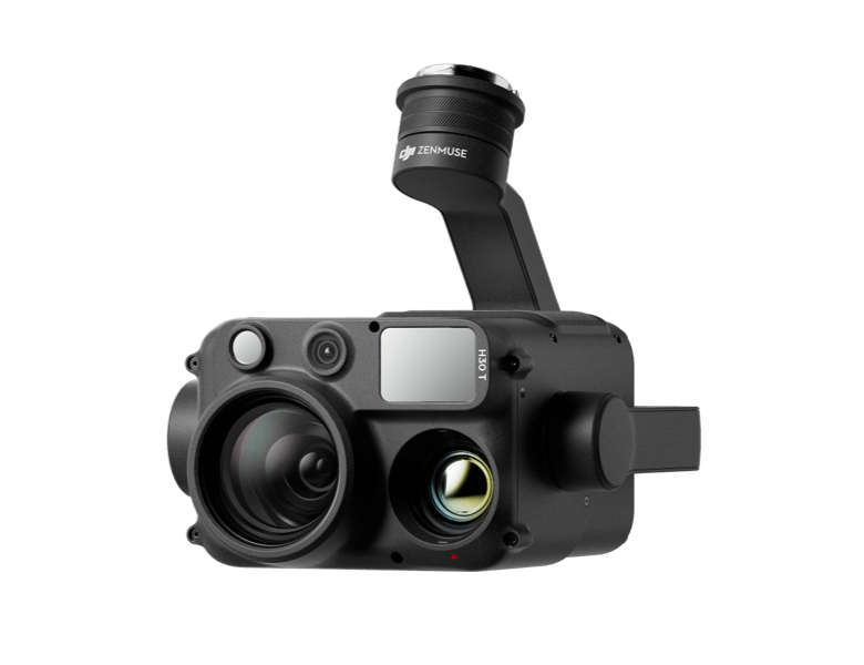
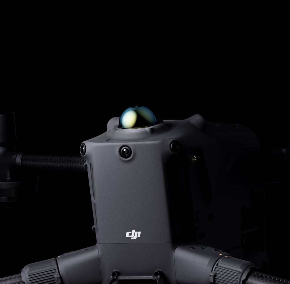
Zenmuse H30 Series [8]
The Zenmuse H30 Series integrates five major modules—a wide-angle camera, a zoom camera, an infrared thermal camera, a laser range finder, and an NIR auxiliary light. Employing cutting-edge intelligent algorithms, it revolutionizes perception and imaging standards, transcending the limitations of day and night vision.
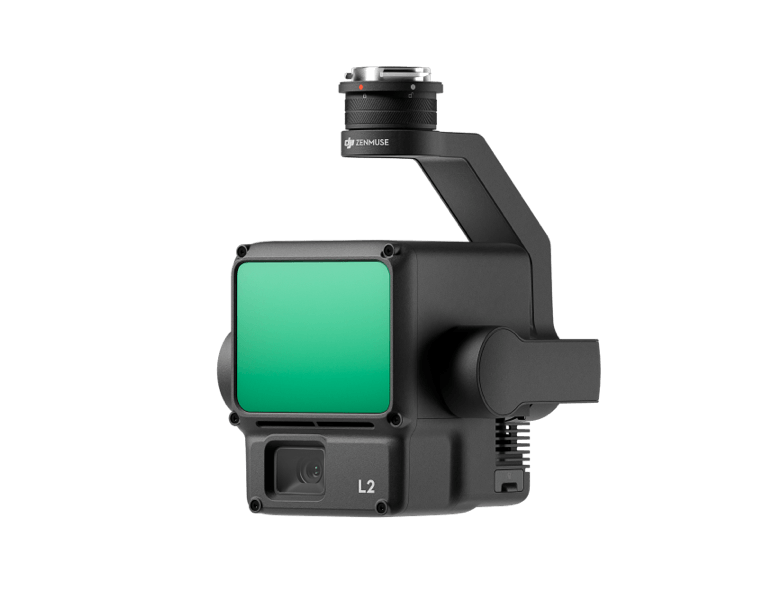
Zenmuse L2 [8]
Zenmuse L2 integrates frame-based LiDAR, a self-developed high-accuracy IMU system, and a 4/3 CMOS RGB mapping camera, providing DJI multi-payload drone platform with more precise, efficient, and reliable geospatial data acquisition.
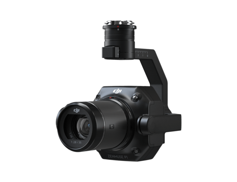
Zenmuse P1 [8]
Zenmuse P1 integrates a full-frame sensor with interchangeable fixed-focus lenses on a 3-axis stabilized gimbal. Designed for photogrammetry flight missions, it takes efficiency and accuracy to a whole new level.
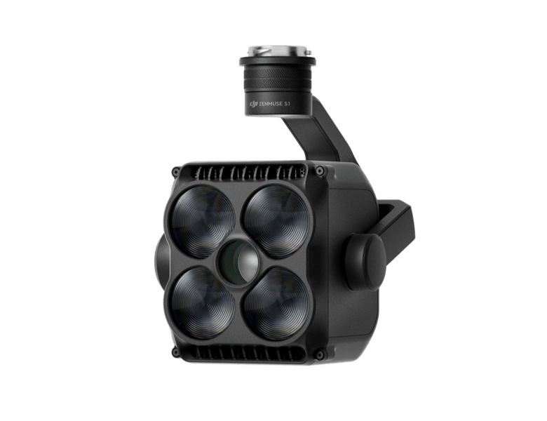
Zenmuse S1 [8]
Zenmuse S1 is DJI's first spotlight designed for multi-payload drone platforms. Utilizing the LEP technology, it offers high brightness and long illumination distance, and supports multiple lighting modes. This makes it ideal for public safety, emergency rescue, inspection, and other nighttime operations.
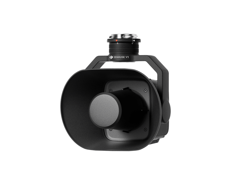
Zenmuse V1 [8]
Zenmuse V1 is DJI's first loudspeaker designed for multi-payload drone platforms. It boasts high volume and long broadcast distance, and supports multiple broadcast modes, making it ideal for scenarios like public safety, emergency rescue, and more.
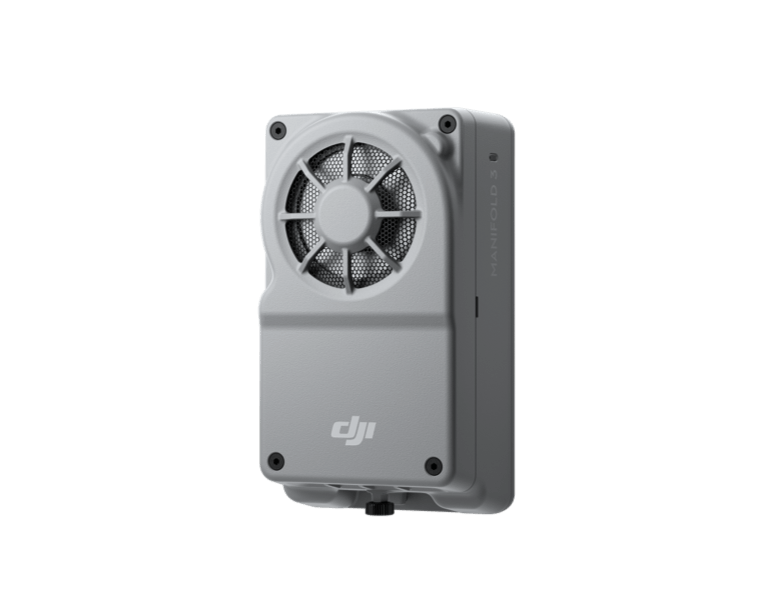
Manifold 3 [8]
Manifold 3 packs an impressive 100 TOPS of computing power into a compact unit weighing about 120 g. It can be mounted onto Matrice 400 drone platform, optimizing efficiency across various operational missions with its robust processing.
Flight Time [1]
Estimate the Matrice 400’s flight time based on payload configuration.
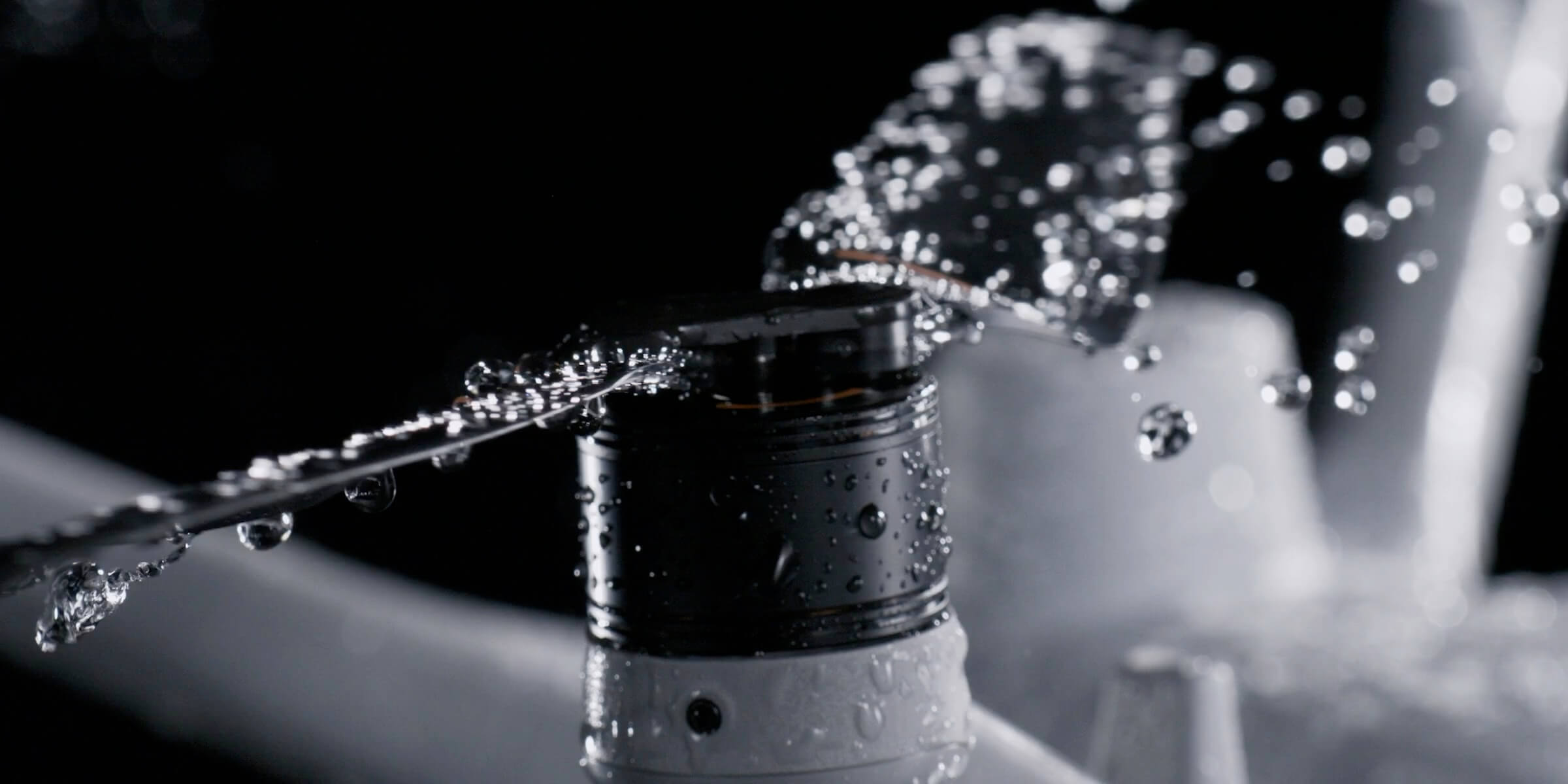
Safe and Reliable Flight
Built for Challenging Conditions
Matrice 400 has a protection rating of IP55 [9], allowing it to operate reliably in challenging conditions including heavy dust or rain. It also maintains stable performance across temperatures from -20° to 50° C (-4° to 122° F), delivering consistent results in both hot and cold conditions.
IP55
IP Rating
-20° to 50° C (-4° to 122° F)
Operating Temperature
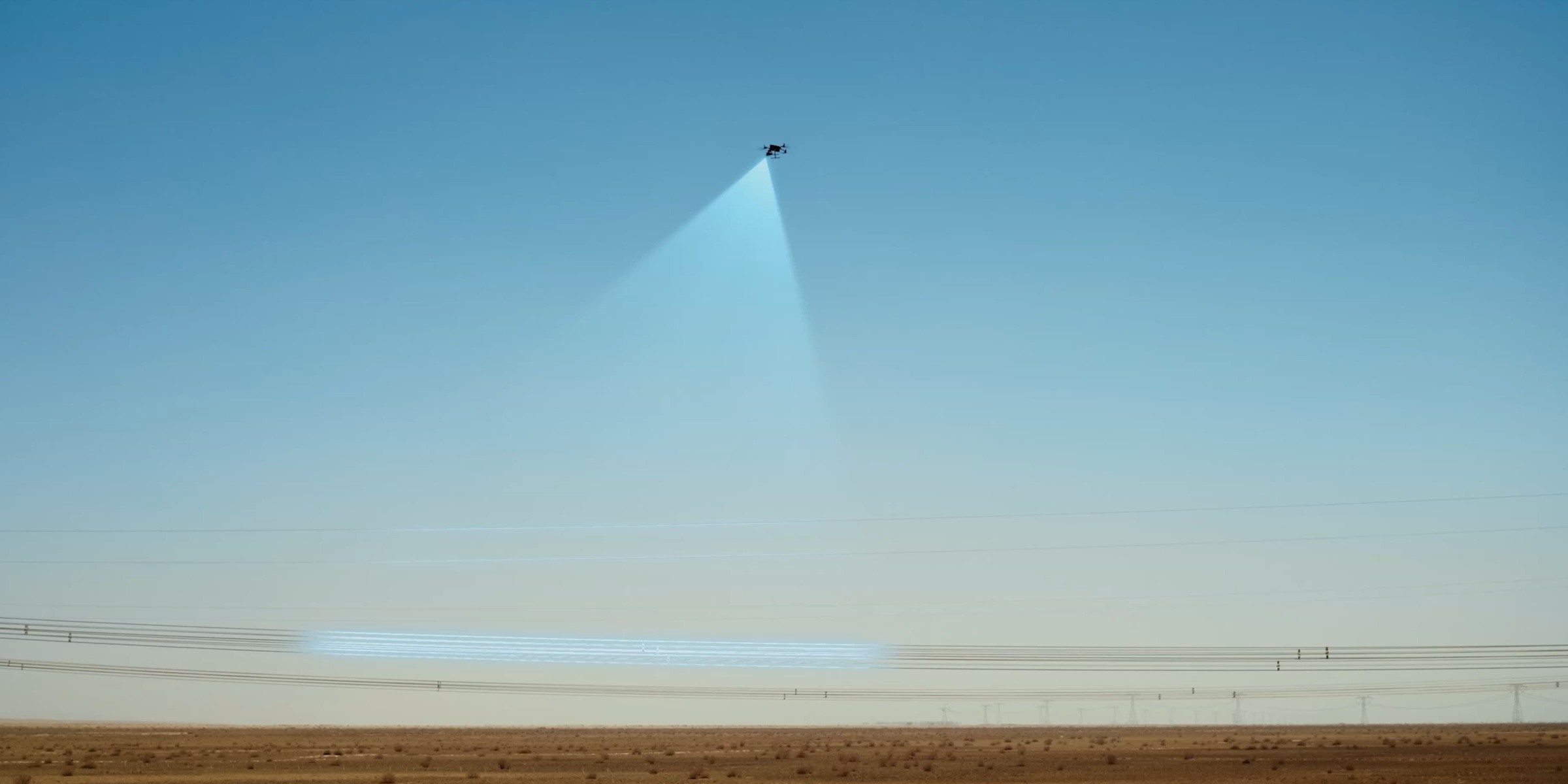
Power-Line-Level Obstacle Sensing [3]
The Matrice 400's advanced obstacle sensing system integrates rotating LiDAR, high-precision mmWave radar, and full-color low-light fisheye vision sensors [13], pushing detection capabilities to unprecedented levels. The system detects even small obstacles like high-voltage power lines across mountainous terrain — even in darkness [3]. It can penetrate rain and fog to sense its surroundings, providing enhanced safety in challenging weather conditions.
Robust Video Transmission

O4 Enterprise Enhanced Video Transmission System
Thanks to the ten-antenna system on the aircraft and the high-gain phased array antenna system on the remote controller, the O4 Enterprise Enhanced Video Transmission System can achieve image transmission up to 40 km [10].
Matrice 400 also supports the sub2G frequency band [5], and when equipped with two DJI Cellular Dongle 2 [11], it can automatically switch to the better available carrier network, providing a more stable signal even in urban interference environments or remote regions.
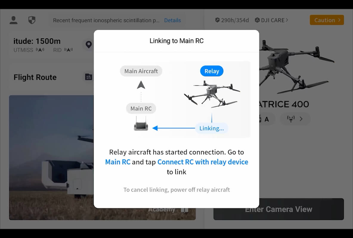
Airborne Relay Video Transmission [5]
Matrice 400 has a built-in video transmission relay module. With this setup, one Matrice 400 can serve as a relay drone, flying high to provide relay signals for another Matrice 400 operating at a greater distance. This capability significantly extends the transmission range, making it ideal for search and rescue tasks as well as inspections in mountainous areas.
Aircraft Fusion Positioning
The omnidirectional sensing performance [12] brought by rotating LiDAR, high-precision mmWave radar, and full-color low-light fisheye vision sensors provides Matrice 400 with strong positioning capabilities. It can fly stably close to glass-facade buildings or wind turbine blades and safely return from building edges, mountain bases, or bridge sides even when the return point has not been updated.
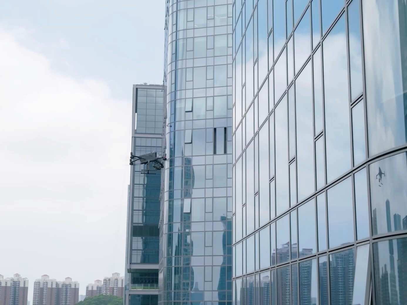
Full-Color Vision Assist
The four full-color low-light fisheye vision sensors on the aircraft provide Full-Color Vision Assist [13] to ensure safer flight.
Enhanced Intelligence and Efficiency
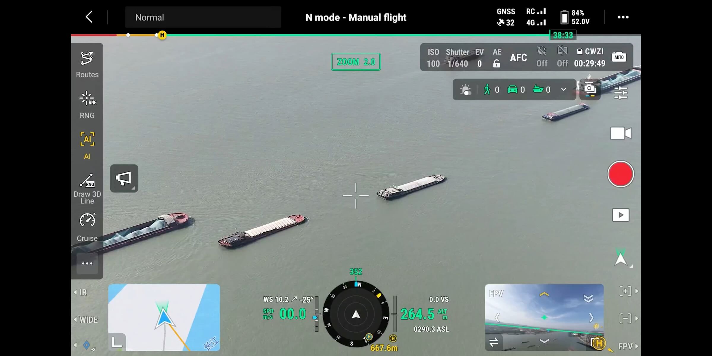
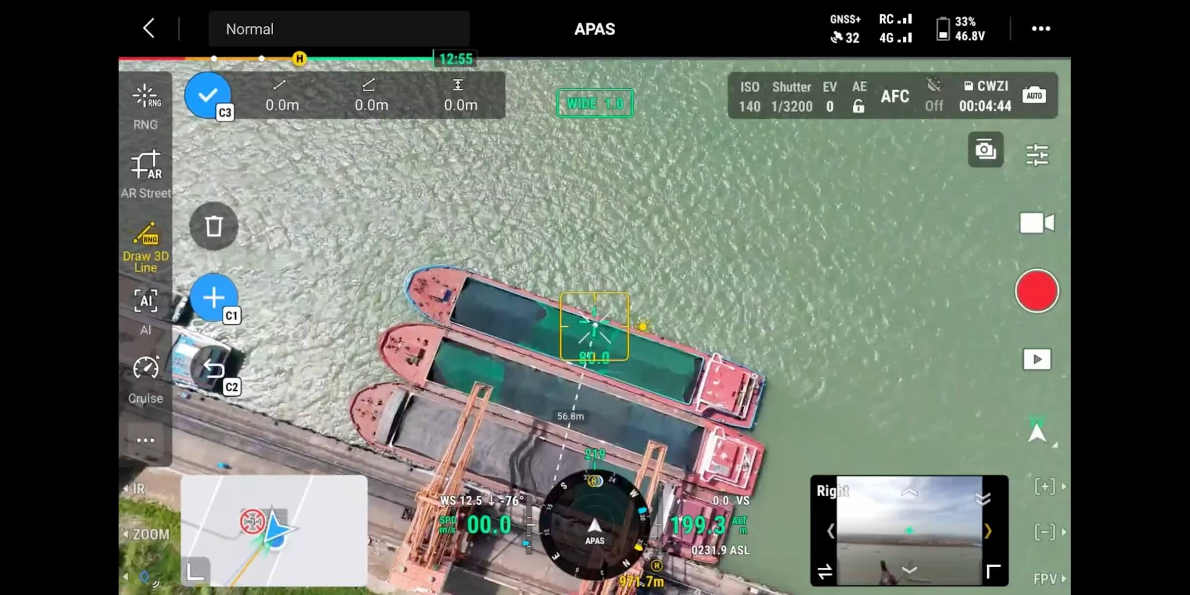
Smart Detection [14]
With Zenmuse H30 Series' visible and thermal imaging, Matrice 400 can detect vehicles, vessels, and subjects during search and rescue operations or routine flights. It also supports switching to other models, enabling the expansion of application scenarios. Additionally, it supports high-res grid photos and features powerful tracking capabilities.
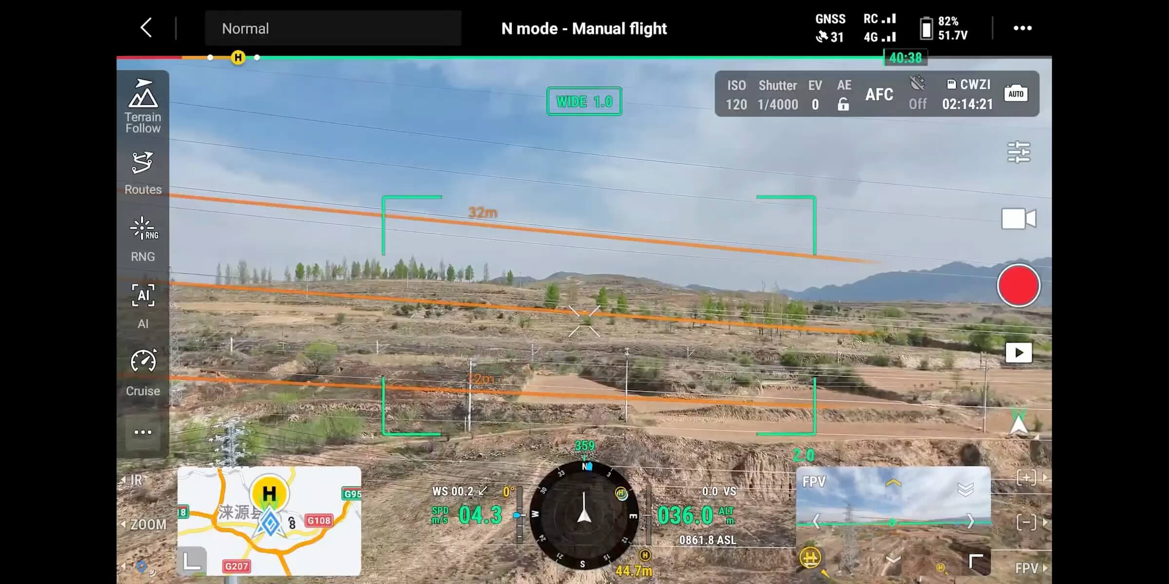
Smart AR Projection
Power Line AR
Map View AR
AR Flight Waypoint
Live Annotations
Without modeling, you can mark points on the remote controller screen to obtain subject locations, draw lines to measure distances between multiple points, and outline areas to calculate their size. Measurement results can be synchronized to the DJI FlightHub 2 to enhance team efficiency.
Real-Time Terrain Follow
Matrice 400 supports Real-Time Terrain Follow flight in any horizontal direction [15]. This feature can be enabled during both manual flight and automated flight routes, ensuring stable relative height to the ground.
During large-scale search and rescue operations, the size of ground subjects can be kept consistent on the remote controller screen, reducing the need for frequent zoom adjustments and improving efficiency. During mapping missions, a consistent ground sampling distance (GSD) can be maintained to obtain high-precision mapping data.
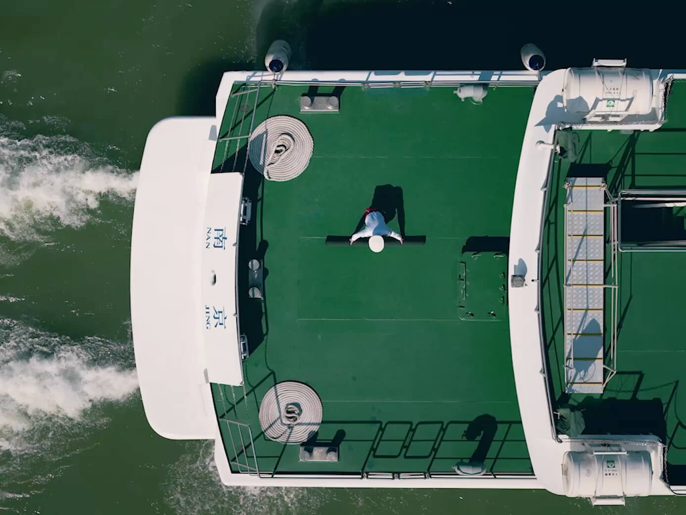
Takeoff and Landing on Ships [16]
To address the needs of offshore operations such as maritime patrol and wind turbine inspection, Matrice 400 is equipped with the capability to take off from and land on ships, supporting takeoff from stationary vessels and landing on moving vessels. By detecting landing point patterns on the deck, it can achieve safe and precise landings.
Intelligent Flight Modes
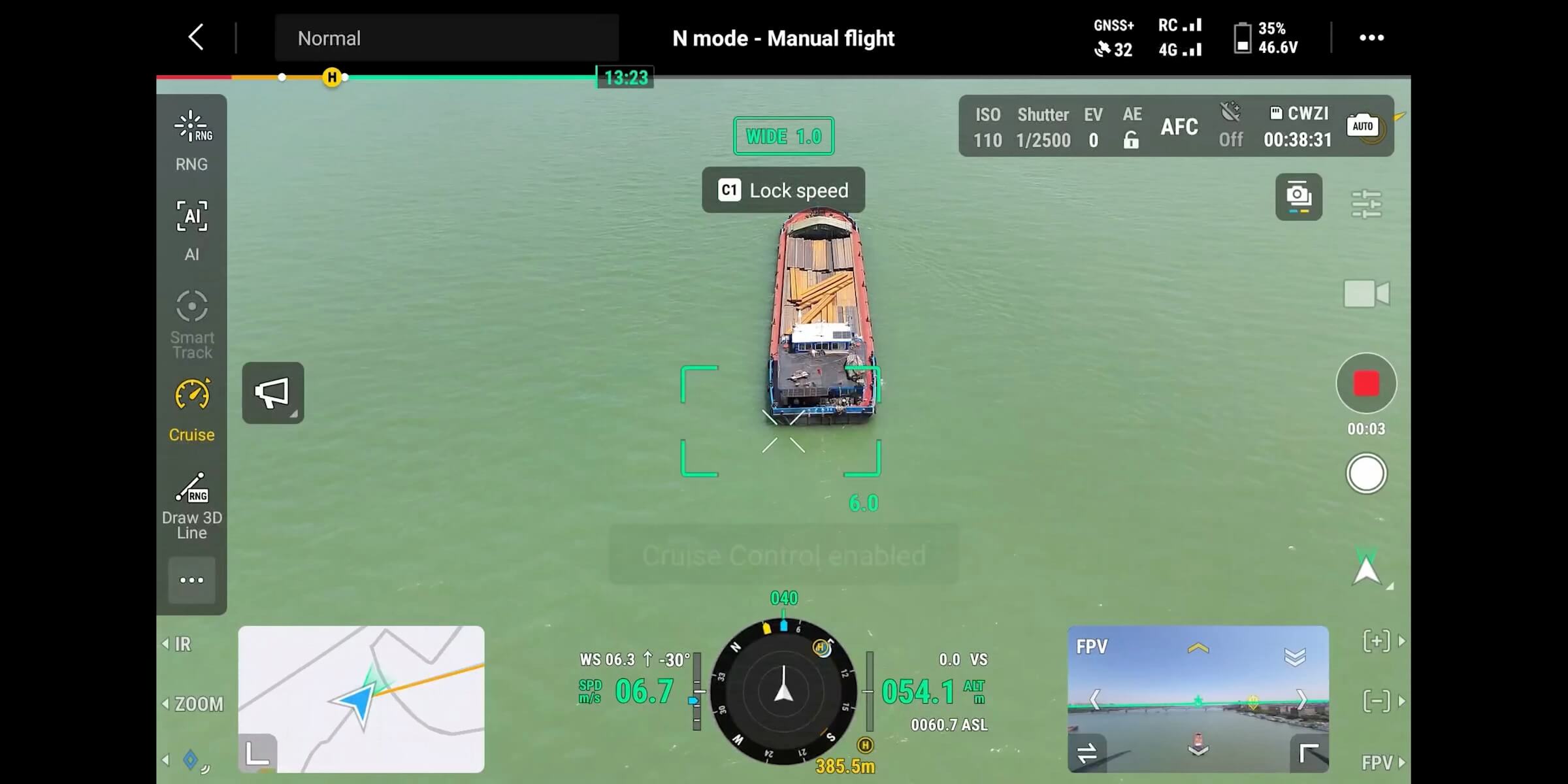
Cruise
FlyTo
Smart Track
POI
Activate cruise control mode to pilot the drone in a specific direction without constantly pressing the control sticks, making long-distance flights or linear inspections easier.
Easier Automated Operations
Power Line Follow With Zenmuse L2
Slope Route & Geometric Route
When equipped with the L2 LiDAR system, Matrice 400 can perform automated power transmission and distribution line following flights. It uses the rotating LiDAR to detect obstacles in real time and automatically bypasses crossing lines.
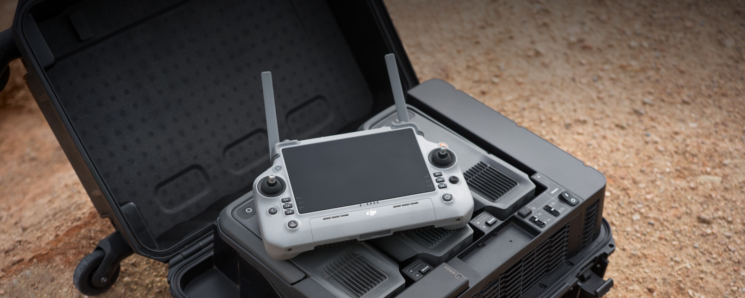
Comprehensive Accessory Upgrades [17]
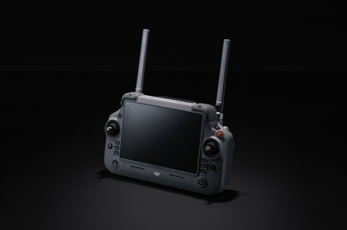
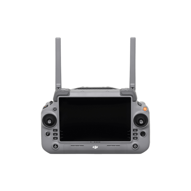
DJI RC Plus 2 Enterprise Enhanced
DJI RC Plus 2 Enterprise Enhanced Remote Controller features a new high-brightness screen that remains clearly visible even in direct sunlight. It has an IP54 protection rating and can operate in temperatures ranging from -20° to 50° C (-4° to 122° F). Equipped with the O4 Enterprise Enhanced Video Transmission, it features a built-in high-gain antenna array, providing strong performance. It also supports the sub2G module and 4G hybrid transmission solutions, ensuring stable and smooth video feeds in both urban high-rise and mountainous environments.
DJI RC Plus 2 Enterprise Enhanced
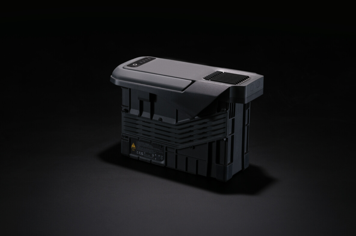
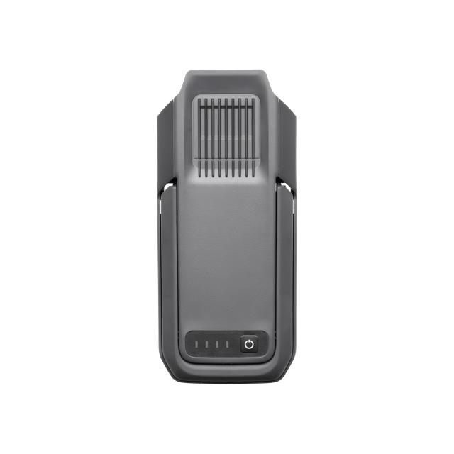
TB100 Battery
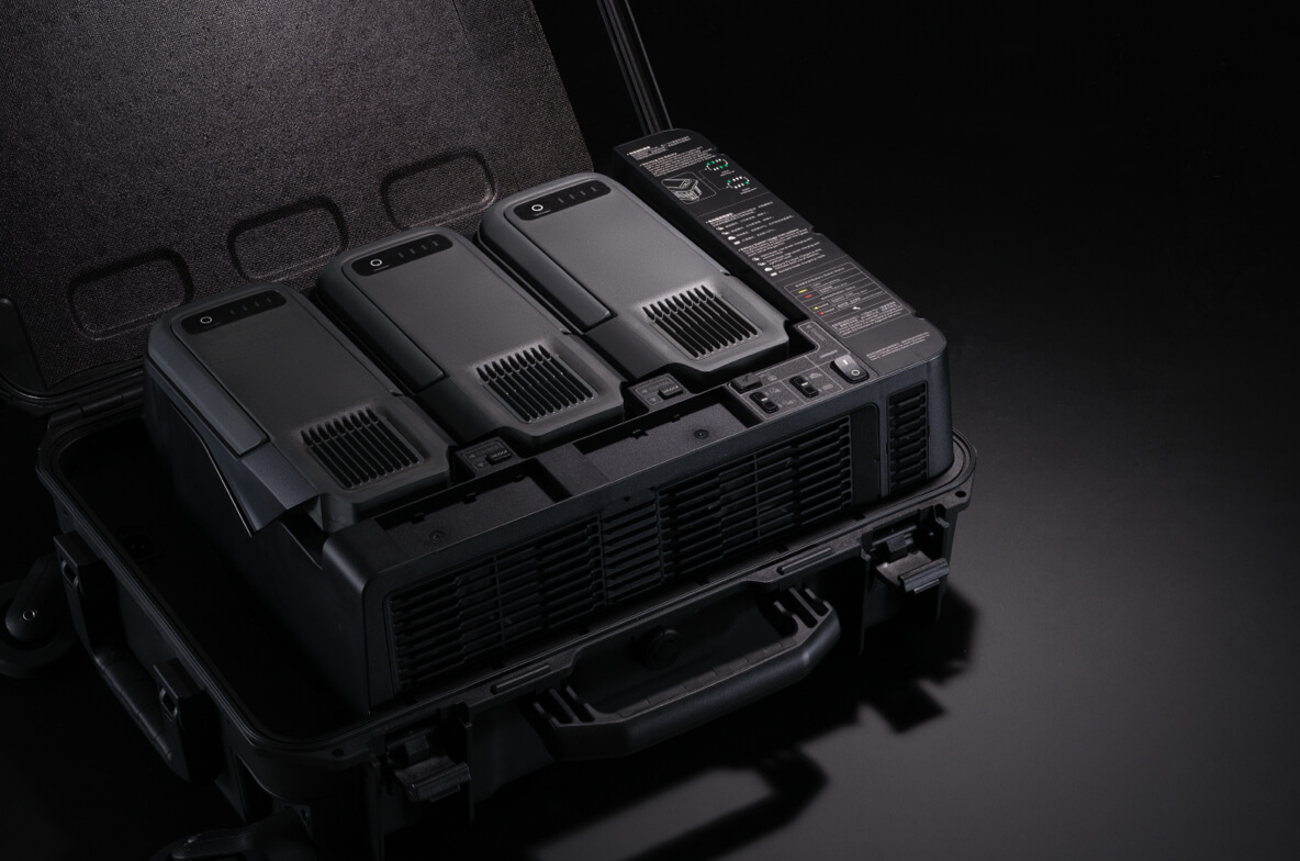
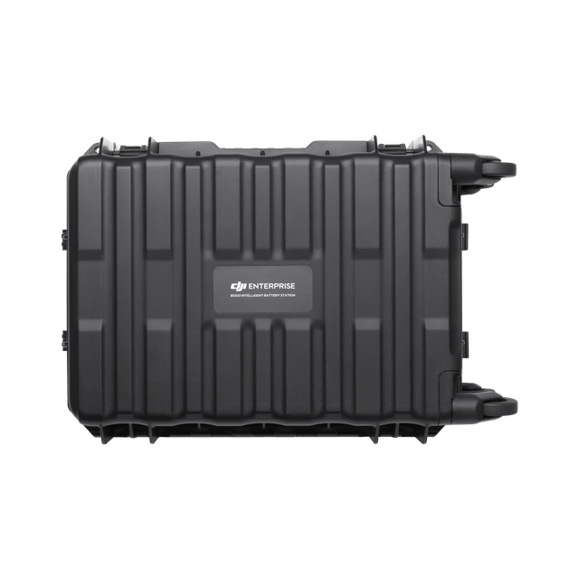
BS100 Intelligent Battery Station
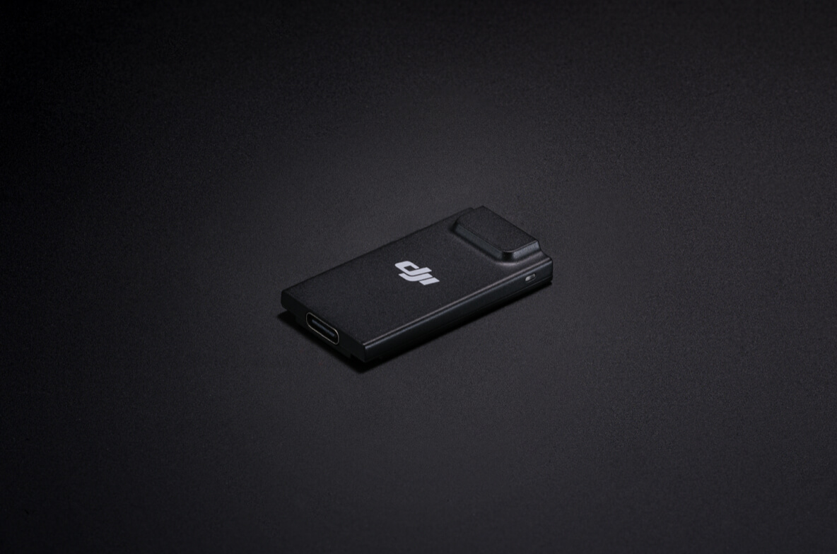
DJI Cellular Dongle 2 [11]
TB100C Tethered Battery
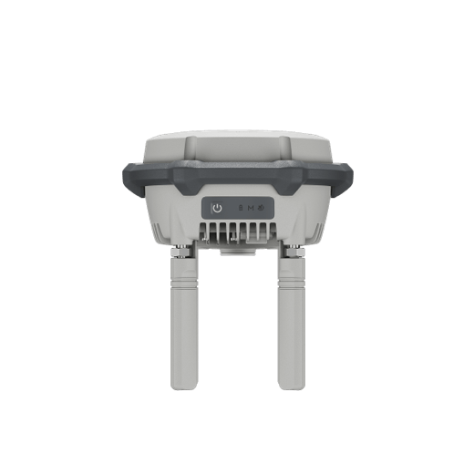
D-RTK 3 Multifunctional Station
Software Designed for Industries
DJI FlightHub 2
DJI Terra
DJI Modify
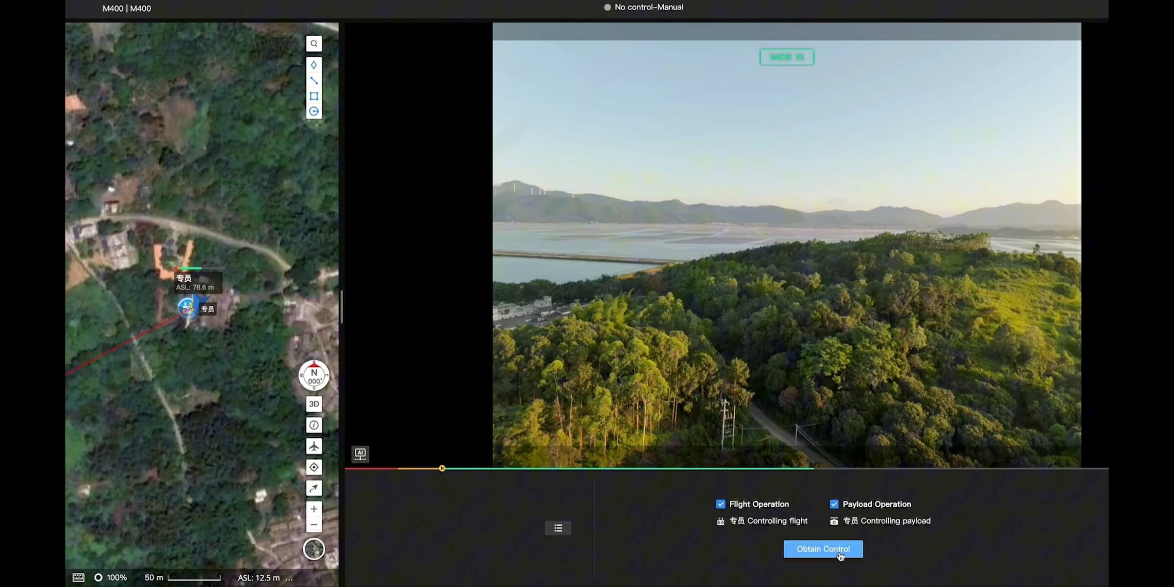
Specifically for the Matrice 400, DJI FlightHub 2 has been upgraded to enable cloud-based remote control, allowing operators to control the aircraft's flight attitude and official payloads, as well as to perform remote takeoff, landing, and Live Flight Controls. In addition, it supports a wide range of flight route planning functions, including slope routes, geometric routes, and other advanced route types. During multi-drone operations, operators can remotely synchronize and display multiple livestreams across screens, creating a new, efficient air-ground integrated operation experience.
* Users who purchase Matrice 400 and bind it to FlightHub 2 upon activation will receive allocated live streaming minutes, map imagery quotas, and cloud storage space.
Open Developer Ecosystem
Intelligent Algorithm Developer
Provides the necessary model training tools and third-party developer certification process to access onboard computing capability, helping to expand new application fields for drones.
PSDK
The newly upgraded E-Port V2 supports USB 3.0 high-speed payload communication and delivers up to 120 watts of power per port. The E4 port of the E-Port V2 can be expanded into four payload ports via the E-Port Hub expansion plate, unlocking broader application scenarios and greater potential for the Matrice 400.
MSDK
Mobile SDK 5 simplifies the development of apps to control the Matrice 400. It comes with fully open-source, production-level code samples with core modules adapted from DJI Pilot 2, guaranteeing high reliability.
Cloud API
With DJI Pilot 2's built-in Cloud API (MQTT-based protocol), you can directly connect the Matrice 400 to third-party cloud platforms. Access the drone's hardware, video live-stream, and photo data without having to develop an app.
Open Data Access
Developers can leverage payload, LiDAR, mmWave radar, and vision sensor data interfaces to build innovative applications and expand the DJI ecosystem.
User Data Security
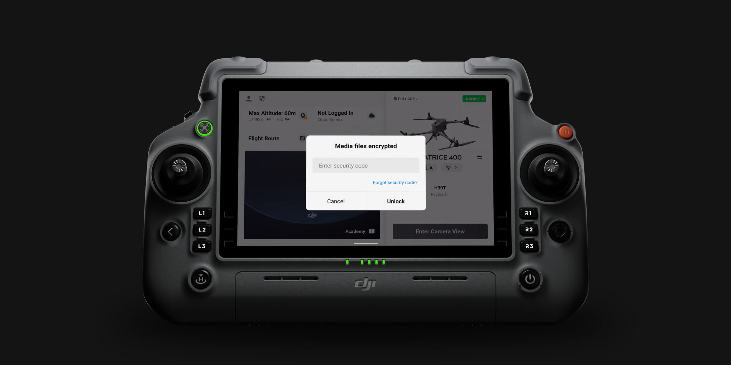
Media Data Encryption
Local Data Mode
One-Tap Clear Logs
AES-256 Video Transmission Encryption
Cloud API
Get 1 Year of DJI Care Enterprise Plus or 1 Year of Official Extended Warranty Service for Free [20]
DJI Care Enterprise Plus
Comprehensive Protection | Professional Quality Assurance | Exclusive Service | Service Starts with Activation
Free Repairs
Unlimited number of free repairs within the coverage limit
Battery Replacement
1 battery per year, long-lasting runtime
Coverage for Your Whole Fleet
Shared limit for maximum protection
Free Two-Way Shipping
Free mail-in repairs, hassle-free service
Expert Service
Rapid response from DJI product experts
Full Device Coverage
Worry-free support for every mission
Extended Warranty Service
In addition to the standard warranty, an extra 1-year warranty service is provided. Major parts are covered by the official warranty, with support provided by our professional engineers.
Official Service
Supported by professional engineers
Quality Repairs
Original parts, guaranteed quality
Application Scenarios
Public Safety
Power Line Inspection
Geographic Information
Oil and Natural Gas
Renewable Energy
Water Conservation
Maritime
Roads and Bridges
Aircraft
Takeoff Weight (with propellers)
Without Batteries: 5020±20 g
With Batteries: 9740±40 g
The actual product weight may vary due to differences in batch materials and external factors.
Max Takeoff Weight
15.8 kg
Dimensions
Unfolded: 980×760×480 mm (L×W×H) (with landing gear)
Folded: 490×490×480 mm (L×W×H) (with landing gear and gimbal)
Maximum dimensions excluding propellers.
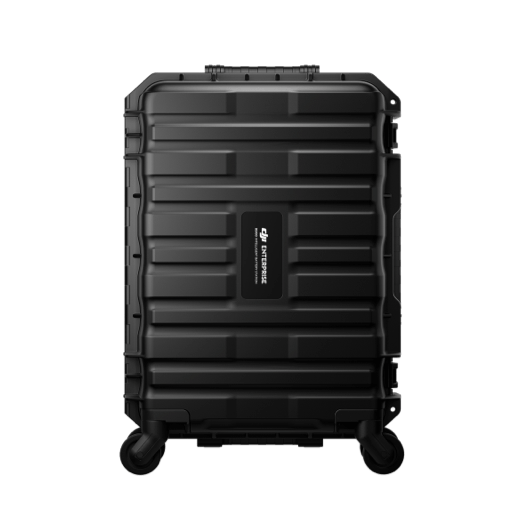
Aircraft carrying case dimensions: 779×363×528 mm (L×W×H)
Max Payload
6 kg
The 6 kg payload is measured at the third gimbal connector under sea level conditions. Payload capacity decreases as altitude increases. For details, refer to the official user manual.
Propeller Size
25 inches
Diagonal Wheelbase
1070 mm
Max Ascent Speed
10 m/s
Max Descent Speed
8 m/s
Max Horizontal Speed (at sea level, no wind)
25 m/s
Max Takeoff Altitude
7000 m
Max Flight Time (no wind)
59 minutes
Measured with the aircraft flying forward at a constant speed of 10 m/s in a windless environment at sea level, carrying only the H30T (total weight 10,670 g), and from 100% battery level until 0%. Data is for reference only. Actual experience may vary depending on the environment, usage, and firmware version.
Max Hover Time (no wind)
53 minutes
Measured with the aircraft hovering in a windless environment at sea level, carrying only the H30T (total weight 10,670 g), and from 100% battery level until 0%. Data is for reference only. Actual usage time may vary depending on the flight mode, accessories, and environment.
Max Flight Distance (no wind)
49 km
Measured by the aircraft flying forward at a constant speed of 17 m/s in a windless environment at sea level, without external payloads, and from 100% battery level until 0%. Actual experience may vary depending on the environment, usage, and firmware version.
Max Wind Speed Resistance
12 m/s
Max wind speed resistance during takeoff and landing.
Max Yaw Angular Velocity
Yaw: 100°/s
Max Pitch Angle
35°
Operating Temperature
-20° to 50° C (-4° to 122° F) (without solar radiation)
Global Navigation Satellite System (GNSS)
GPS + Galileo + BeiDou + GLONASS*
* GLONASS is supported only when the RTK module is enabled.
Equipped with standard airborne ADS-B In receiver and dual antennas, supporting reception up to 20 km.
Hovering Accuracy Range (with moderate or no wind)
Vertical:
±0.1 m (with vision positioning)
±0.5 m (with satellite positioning)
±0.1 m (with RTK positioning)
Horizontal:
±0.3 m (with vision positioning)
±0.5 m (with satellite positioning)
±0.1 m (with RTK positioning)
RTK GNSS Accuracy
RTK Fix:
1 cm + 1 ppm (horizontal), 1.5 cm + 1 ppm (vertical)
RTK Heading
Supports RTK heading with an accuracy better than 2°
Airborne ADS-B In
Equipped with standard airborne ADS-B In receiver and dual antennas, supporting reception up to 20 km.
Internal Storage
N/A
Ports
USB-C Debug Port × 1: USB 2.0
E-Port V2 × 4: At the lower part of the drone, with 120W single-port power
Cellular Dongle 2 Interface × 2: On the underside of the drone
Propeller Model
2510F
Beacon
Built into the aircraft
Ingress Protection Rating
IP55
The rating is not permanently effective and may decrease due to product wear and tear.
Gimbal
Maximum Payload for Single Gimbal Connector
1400 g
If exceeds, the gimbal damper lifespan will decrease from 1000 hours to 400 hours.
Maximum Payload for Dual Gimbal Connector
950 g
Maximum Payload for Third Gimbal Connector
3 kg for quick-release port, 6 kg for screw lock fastening
Sensing
Sensing Type
Omnidirectional binocular vision system (surround view provided by full-color fisheye vision sensors)
Horizontal rotating LiDAR, upper LiDAR and downward 3D infrared range sensor
Six-direction mmWave radar
Forward
Measurement Range: 0.4-21 m
Detection Range: 0.4-200 m
Field of View (FOV): 90° (horizontal), 90° (vertical)
Backward
Measurement Range: 0.4-21 m
Detection Range: 0.4-200 m
Field of View (FOV): 90° (horizontal), 90° (vertical)
Lateral
Measurement Range: 0.6-21 m
Detection Range: 0.5-200 m
Field of View (FOV): 90° (horizontal), 90° (vertical)
Downward
Measurement Range: 0.5-19 m
The FOV to the front and rear is 160° and 105° to the right and left.
Operating Environment
Forward, Backward, Left, Right, and Upward:
Delicate texture on the surface, adequate light.
Downward:
The ground has rich textures and sufficient lighting conditions*, with a diffuse reflection surface and a reflectivity greater than 20% (such as walls, trees, people, etc.).
* Sufficient lighting conditions refer to an illuminance not lower than that of a nighttime city light scene.
Rotating LiDAR
Standard Measurement Range: 0.5-100 m @ 100,000 lux with 10% reflectivity target
Measurement Range for Power Line: 35 m @ 30° @ 10,000 lux for 21.6 mm steel-core aluminum stranded wire with a relative body tilt angle of 30° to the left and right
Field of View (FOV): 360° (horizontal), 58° (vertical)
Point-Frequency: 520,000 points/second
Laser Wavelength: 905 nm
Eye Safety Level: Class 1 (IEC60825-1:2014), eye-safe
Upper LiDAR (3D ToF)
0.5-25 m at night (reflectivity > 10%)
The FOV to the up and down is 60° and 60° to the right and left.
Downward 3D Infrared Range Sensor
Measurement Range: 0.3-8 m (reflectivity > 10%)
The FOV to the front and rear is 60° and 60° to the right and left.
mmWave Radar
Measurement Range for Power Line:
36 m for a 12.5mm steel-core aluminum stranded wire
50 m for a 21.6mm steel-core aluminum stranded wire
FOV: ± 45° (horizontal and vertical)
The mmWave radar function is unavailable in some countries/regions.
FPV Camera
Resolution
1080p
Field of View (FOV)
DFOV: 150°
HFOV: 139.6°
VFOV: 95.3°
Frame Rate
30fps
Night Vision
Starlight Grade
Video Transmission
Video Transmission System
DJI O4 Enterprise Enhanced Video Transmission System
Live View Quality
Remote Controller: 3-channel 1080p/30fps
Operating Frequency and Transmitter Power (EIRP)
902-928 MHz: < 30 dBm (FCC), < 16 dBm (MIC)
1.430-1.444 GHz: < 35 dBm (SRRC)
2.4000-2.4835 GHz: < 33 dBm (FCC), < 20 dBm (CE/SRRC/MIC)
5.150-5.250 GHz: < 23 dBm (FCC/CE)
5.725-5.850 GHz: < 33 dBm (FCC), < 14 dBm (CE), < 30 dBm (SRRC)
Operating frequency allowed varies among countries and regions. Refer to local laws and regulations for more information.
Max Transmission Distance (unobstructed, free of interference)
40 km (FCC)
20 km (CE/SRRC/MIC)
Measured in an unobstructed environment free of interference. The above data shows the farthest communication range for one-way, non-return flights under each standard. During your flight, please pay attention to RTH reminder on the DJI Pilot 2 app.
Max Transmission Distance (with interference)
Strong interference (dense buildings, residential areas, etc.): approx. 1.5-6 km
Medium interference (suburban counties, city parks, etc.): approx. 6-15 km
Weak interference (open spaces, remote areas, etc.): approx. 15-40 km
Data is tested under FCC standard in unobstructed environments of typical interference. Only to serve as a reference and provides no guarantee as to the actual flight distance.
Max Download Speed
Standard Mode: 80Mbps Downlink
Playback Download: < 25 MBps
Single-Channel Bitrate: ≤ 12 Mbps
The above data was measured under conditions where the aircraft and remote controller were in close proximity without interference.
Antenna
WLAN Antenna × 8: 6 vertically polarized antennas and 2 horizontally polarized antennas
sub2G Antenna × 2: 2 vertically polarized antennas
4G Antenna × 4
Operating Mode: 2T4R
Others
Supports Dual Control Mode and 2-channel Cellular Dongle 2
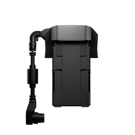
Battery
Model
TB100
Capacity
20254 mAh
Standard Voltage
48.23 V
Max Charging Voltage
54.6 V
Cell Type
Li-ion 13S
Energy
977 Wh
Weight
4720 ± 20 g
Charging Temperature
5° to 45° C (41° to 113° F)
Discharging Temperature
-20° to 75° C (-4° to 122° F)
Battery Heating
Single Battery: Support
Onboard: Support
Battery Station: Support
Discharge Rate
4C
Max Charging Power
2C
Low-Temperature Charging
Supports low-temperature self-heating charging
Cycle Count
400
Intelligent Battery Station
Model
BS100
Net Weight
11.8 kg
Dimensions
605×410×250 mm (L×W×H)
Supported Batteries
TB100 Intelligent Flight Battery, TB100C Tethered Battery
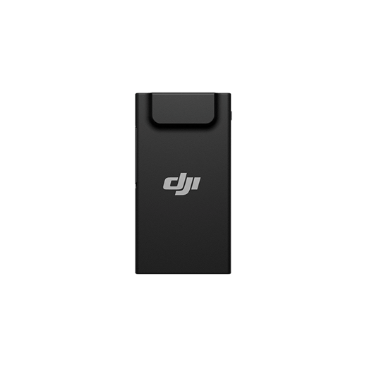
WB37 Battery
Operating Temperature
-20° to 40° C (-4° to 104° F)
Input
100-240 V (AC), 50-60 Hz, 10 A
Output
USB-C:
TB100 Battery Interface:
100-110 V: Approx. 1185 W
110-180 V: Approx.1474 W
180-240 V: Approx. 2184 W
WB37 Battery Interface:
100-240 V: Approx. 52 W
USB-C:
5.0 V 3.0 A, 9.0 V 3.0 A, 12.0 V 3.0 A, 15.0 V 3.0 A, 20.0 V 3.25 A
Number of Charging Channels
Three TB100 and two WB37 batteries
Charging Mode
Ready-to-Fly Mode 90%; Standard Mode 100%
Supports Fast Charging Mode and Silent Mode
Charging Time
TB100/TB100C Battery From 0% to 100%:
220 V: 45 minutes (Fast Charging Mode); 110 minutes (Silent Mode)
110 V: 70 minutes (Fast Charging Mode); 110 minutes (Silent Mode)
Charging time is measured in a test environment with a temperature of 25° C.
DJI RC Plus 2 Enterprise Enhanced
Video Transmission System
DJI O4 Enterprise Enhanced Video Transmission System
Max Transmission Distance (unobstructed, free of interference)
40 km (FCC)
20 km (CE/SRRC/MIC)
Measured in an unobstructed environment free of interference. The above data shows the farthest communication range for one-way, non-return flights under each standard. During your flight, please pay attention to RTH reminder on the DJI Pilot 2 app.
Video Transmission Operating Frequency and Transmitter Power (EIRP)
902-928 MHz: < 30 dBm (FCC), < 16 dBm (MIC)
2.400-2.4835 GHz: < 33 dBm (FCC), < 20 dBm (CE/SRRC/MIC)
5.150-5.250 GHz: < 23 dBm (FCC/CE)
5.725-5.850 GHz: < 33 dBm (FCC), < 14 dBm (CE), < 30 dBm (SRRC)
Operating frequency allowed varies among countries and regions. Refer to local laws and regulations for more information.
Antenna
2T4R, 2.4GHz/5.8GHz multi-beam high-gain antenna
sub2G Module: 2T2R
Enhanced Transmission
Supports DJI Cellular Dongle 2
Wi-Fi Protocol
Wi-Fi Direct, Wireless Display, IEEE 802.11 a/b/n/ac/ax
Supports 2×2 MIMO Wi-Fi, dual-band simultaneous (DBS) support for dual MAC, with data rates up to 1774.5 Mbps (2×2 + 2×2 11ax dual-band simultaneous)
Wi-Fi Operating Frequency
2.4000-2.4835 GHz
5.150-5.250 GHz
5.725-5.850 GHz
5.2 and 5.8GHz frequencies are prohibited in some countries. In some countries, the 5.2GHz frequency is only allowed for use in indoor.
Wi-Fi Transmitter Power (EIRP)
2.4 GHz: < 26 dBm, < 20 dBm (CE/SRRC/MIC)
5.1 GHz: < 23 dBm (FCC/CE/SRRC/MIC)
5.8 GHz: < 23 dBm (FCC/SRRC), < 14 dBm (CE)
Bluetooth Protocol
Bluetooth 5.2
Bluetooth Operating Frequency
2.400-2.4835 GHz
Bluetooth Transmitter Power (EIRP)
< 10 dBm
Screen Resolution
1920 × 1200
Screen Size
7.02 inches
Screen Frame Rate
60fps
Brightness
1400 nits
Touchscreen Control
10-Point Multi-Touch
Built-in Battery
2S2P High Energy Density 18650 Lithium-ion Battery (6500 mAh @ 7.2 V) 46.8 Wh
External Battery
Optional, WB37 (4920 mAh @ 7.6 V) 37 Wh
Charging Type
Supports PD fast charging, with a maximum 20V/3.25A USB Type-C charger
Storage Capacity
RAM 8G + ROM 128G UFS + expandable storage via microSD card
Charging Time
2 hours for internal battery; 2 hours for internal plus external batteries.
When remote controller is powered off and using a standard DJI charger.
Internal Battery Runtime
3.8 hours
External Battery Runtime
3.2 hours
Output Port
HDMI 1.4
Indicators
Status LED, battery level LED, connection status LED, tricolor light, brightness adjustable according to ambient light
Speaker
Supports buzzer
Audio
Array MIC
Operating Temperature
-20° to 50° C (-4° to 122° F)
Storage Temperature
Within one month: -30° to 45° C (-22° to 140° F)
One to three months: -30° to 35° C (-22° to 113° F)
Three months to one year: -30° to 30° C (-22° to 86° F)
Charging Temperature
5° to 40° C (41° to 104° F)
Supported Aircraft Model
Matrice 400
Global Navigation Satellite System
GPS + Galileo + BeiDou
Dimensions
268×163×94.5 mm (L×W×H)
Width including external antenna folded, thickness including handle and controller sticks.
Weight
1.15 kg (without external battery)
Model
TKPL 2
System Version
Android 11
External Interfaces
HDMI 1.4, SD 3.0, USB-C with OTG support, max 65W PD charging, USB-A with USB 2.0 support
Accessories
Strap/waist support
Supported Products
DJI Products Compatible With Matrice 400
Gimbal Cameras: Zenmuse H30, Zenmuse H30T, Zenmuse L2 and Zenmuse P1
Accessories: Zenmuse S1 (drone spotlight), Zenmuse V1 (drone speaker), Manifold 3, DJI RC Plus 2 sub2G SDR Module, DJI Cellular Dongle 2
RTK Station: D-RTK 3 Multifunctional Station, D-RTK 2 Mobile Station
Ecosystem Accessories: DJI X-Port
DJI E-Port V2 Development Kit
DJI E-Port V2 Coaxial Cable Kit
DJI SKYPORT V3 Adapter Set
DJI SKYPORT V3 Coaxial Cable Kit
DJI Matrice 400 × 1
TB100 Intelligent Flight Battery × 1
BS100 Intelligent Battery Station × 1
DJI RC Plus 2 Enterprise Enhanced × 1
DJI RC Plus 2 sub2G SDR Module × 1
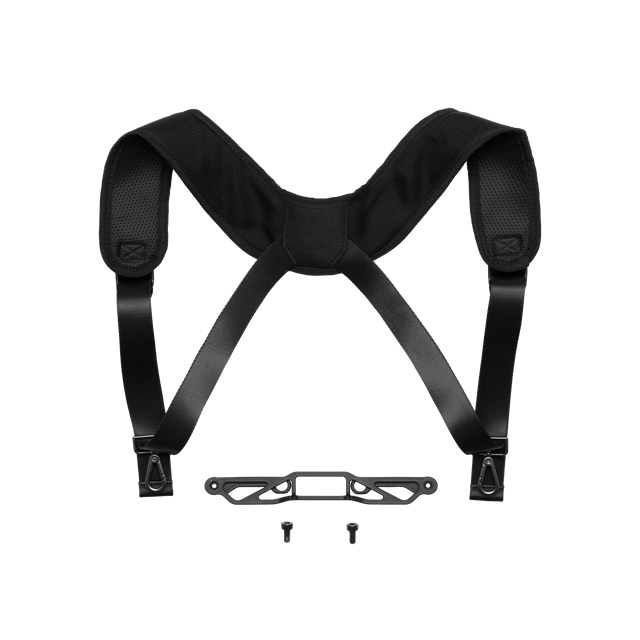
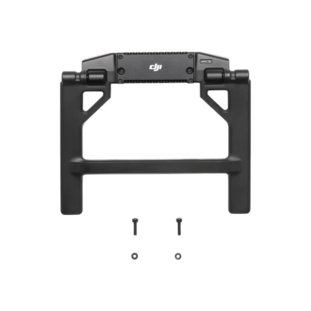
DJI RC Plus 2 Strap and Bracket Kit × 1
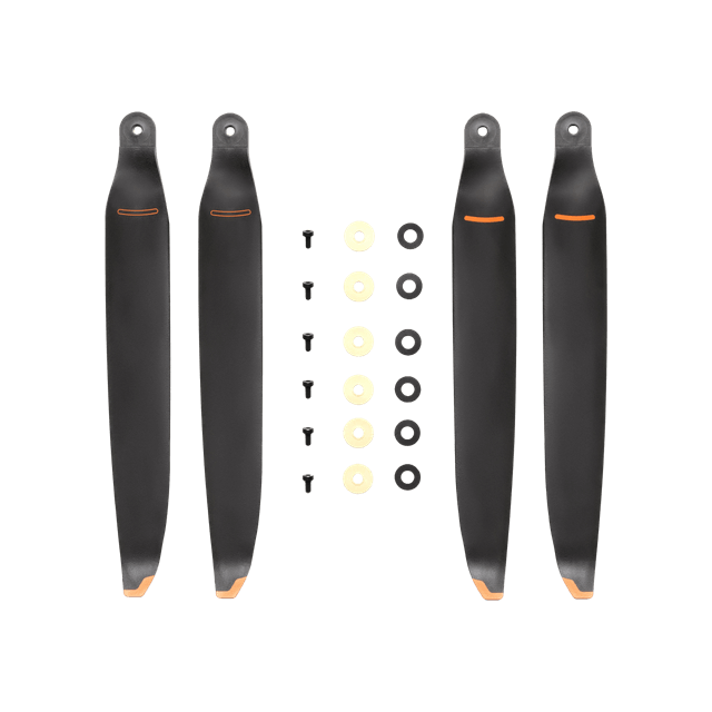
DJI Matrice 400 2510F Propeller × 1
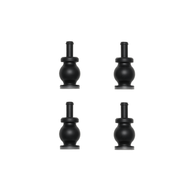
DJI Matrice 400 Gimbal Damper × 1
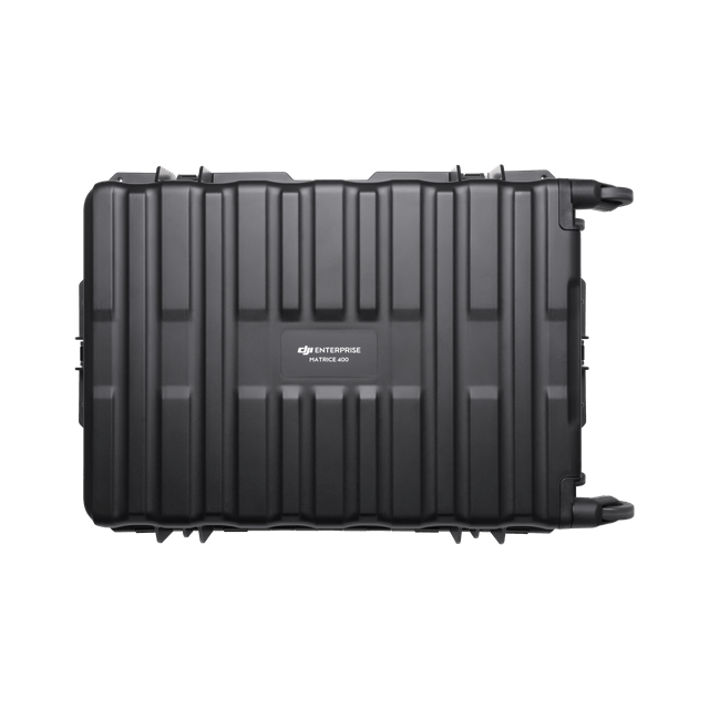
DJI Matrice 400 Carrying Case × 1
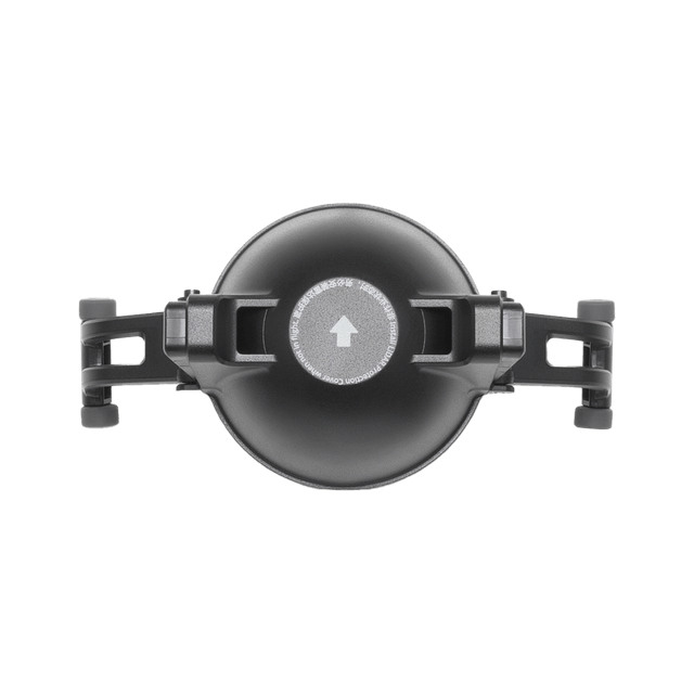
Rotating LiDAR Calibration Cover × 1
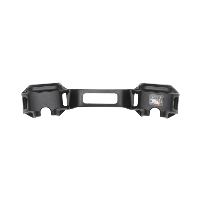
Front Propeller Holder × 1
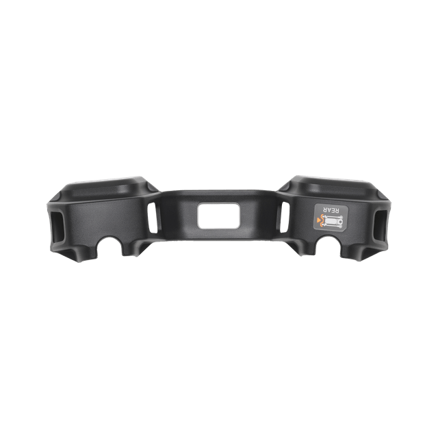
Rear Propeller Holder × 1
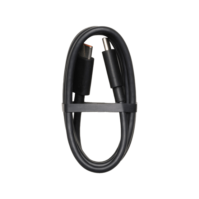
USB-C to USB-C Data Cable × 1
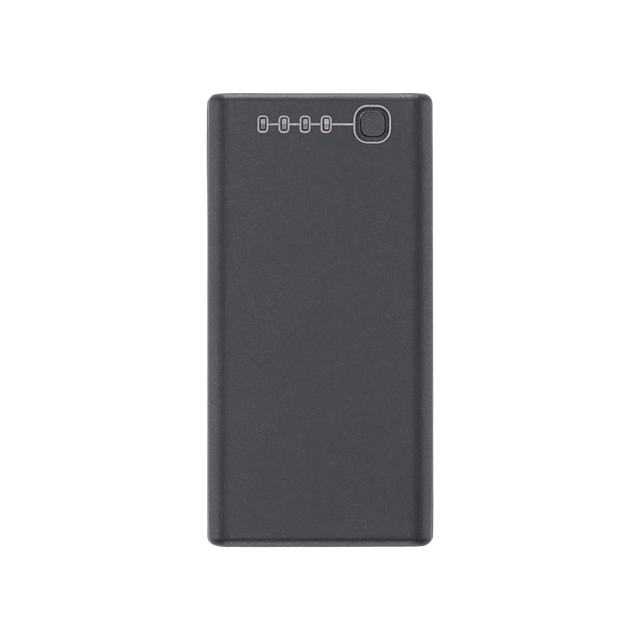
WB37 Battery × 1
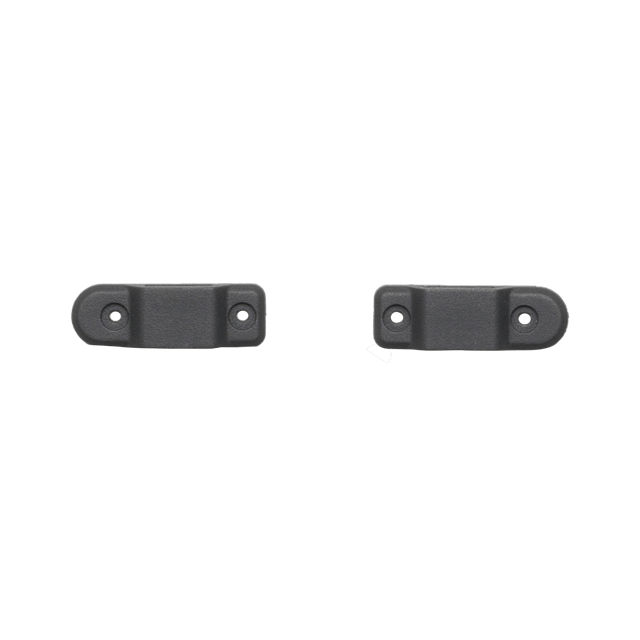
E-Port V2 Rubber Port Cover × 2
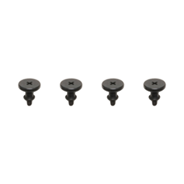
Rubber Plug Screws (2×2) × 4
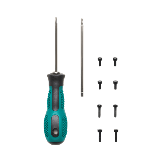
Screws and Tools × 1
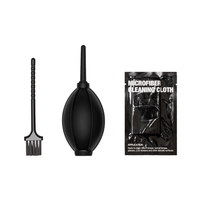
Cleaning Tools × 1
 Local Stock
  Fast Shipment 1-2d.
  Safe Purchase
  2 years Warranty


