

Fast, accurate, high-detail mobile data capture
Featuring AI-powered autonomous mapping, Hovermap incorporates the latest in LiDAR sensing technology to generate high density point clouds with exceptional coverage. With a sensing range of up to 300 meters and the ability to capture more than a million points per second, Hovermap delivers detailed, survey-grade data over a wide area fast – accelerating your time to insight.
Emesent offers a choice of Hovermap business plans designed to match and support your specific LiDAR mapping and data visualization requirements.
Why choose Hovermap?
 | Fast time to insight |
| A LiDAR sensing range of up to 300 meters and triple returns capable of more than one million points per second allow you to capture detailed, accurate data over a greater area in less time – increasing efficiency. | |
 | Survey-grade accuracy |
Emesent's award-winning SLAM solution, automated ground control points and higher resolution LiDAR sensor provide a cleaner point cloud with sub-centimeter precision allowing you to obtain more accurate measurements and improved insights. | |
 | Uniquely versatile |
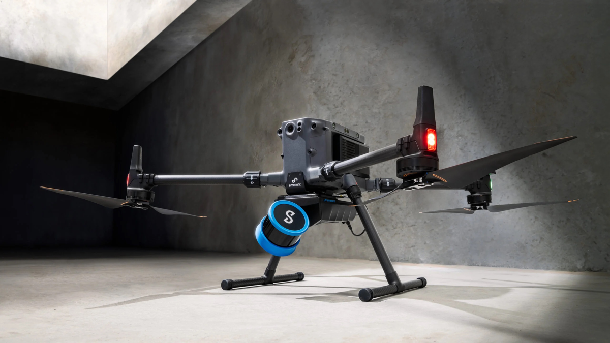
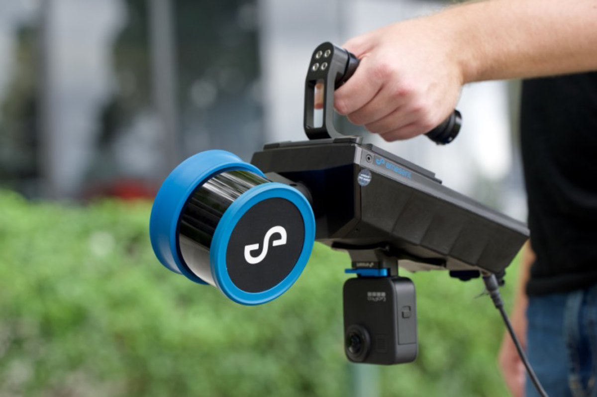
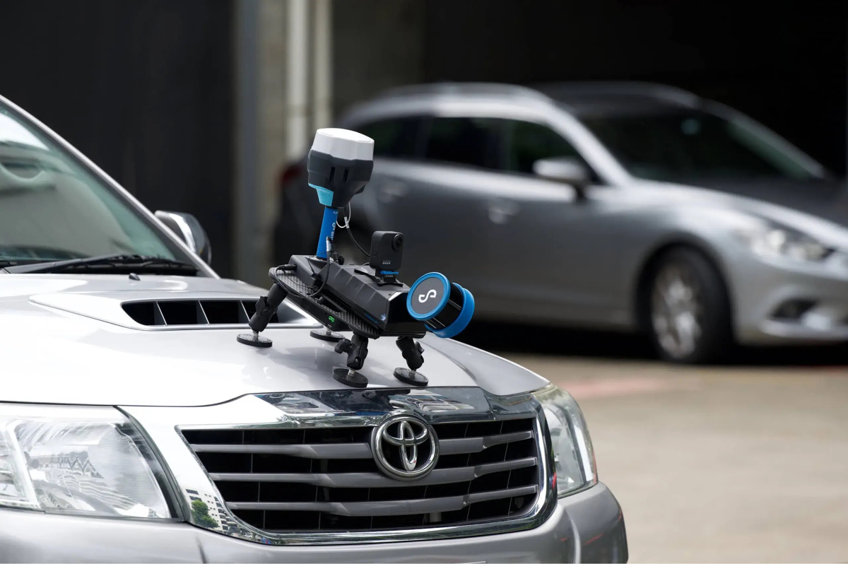
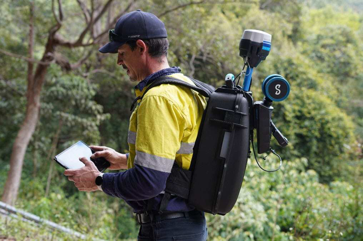
The plug-and-play design and quick-release mechanism allow easy switching between modes. Use Hovermap as a handheld scanner; attached to a drone, vehicle, or pole; lowered in a cage; or mounted to a backpack to easily collect data anywhere. | |
 | Superior detail |
| Capture shadowless, detailed, high quality point clouds of an entire complex asset with high density data sets to reveal richer features. Add a level of reality capture with colorization. | |


Mapping options for every scanning need
Hovermap’s autonomy levels give you the versatility to best capture the environment
you need and the confidence to leave the site knowing you’ve captured everything you need.
In all modes, Hovermap streams a live point cloud to the Hovermap app, providing a
real-time preview of the data as it is captured when in communication range.

Autonomous waypoint mode
Autonomous waypoint mode provides beyond line of sight flight through smart waypoints and guided exploration.Simply tap on the map to set smart waypoints, and hovermap takes care of the rest, navigating to the waypoints, mapping the area, and keeping itself and the drone safe from obstacles.

Pilot assist mode
Pilot assist mode provides omnidirectional collision avoidance, line of sight gps-denied flight capability, and stability control, providing the confidence and stability for close, thorough inspections. It acts as a safety bubble for your drone, keeping the asset and your equipment safe. This mode is available in the plus subscription.

Mapping mode
Mapping mode offers fast, accurate, and high-resolution mobile scanning of environments where drone autonomy is unnecessary. Hovermap’s quick-release mechanism allows you to easily switch from a drone to handheld scanning or a backpack, vehicle, or protective cage for SLAM-based mobile mapping.
 Local Stock
  Fast Shipment 1-2d.
  Safe Purchase
  2 years Warranty


Similar products
 new
new
 new
new
Reserve